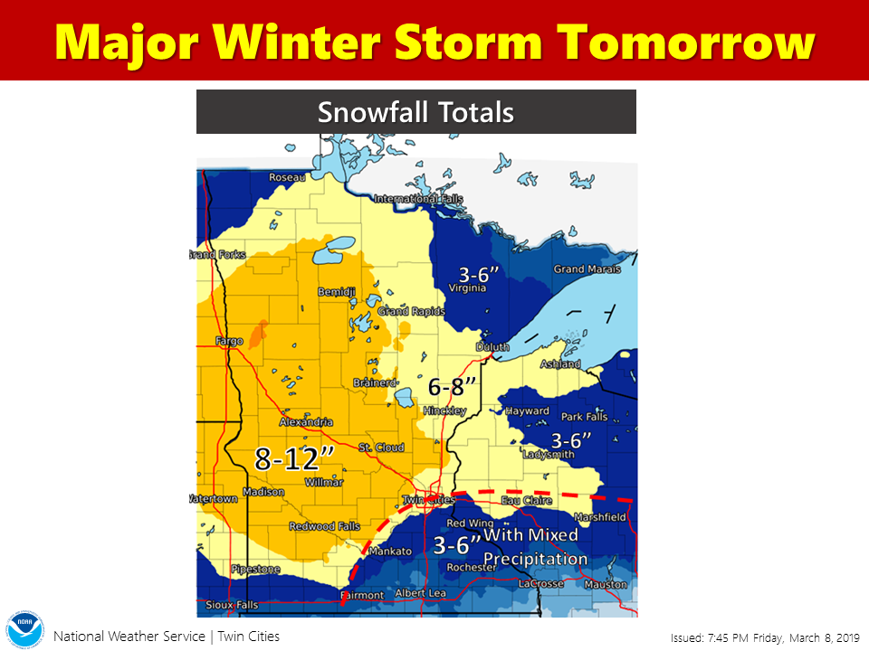
So… here it is. I have a feeling totals will still change. First, let’s look at the timing. It should start late morning to early afternoon.

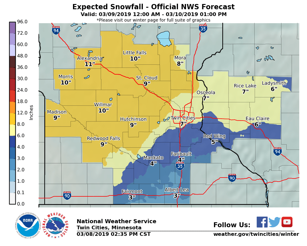
The NWS is saying 4 inches in Mankato is the most likely
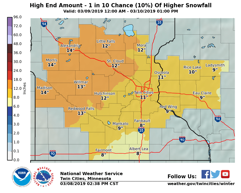
There is still a 10% chance that the Mankato area could get 9 inches or so of snow. Historically, this is on the high side and used the high number in their predictions (from what I have seen anyway).
The models have been consistent in saying we will get about 3/4 of an inch of water falling from the sky (in its various forms). So let’s go to the snow models.


With all this, my prediction is 5-7 inches for the area. This may change overnight yet, and if it does, I’ll be sure to update the total prediction.
I will add that this system can easily shift south and dump 12 inches on us, we’ll probably know more tomorrow.
Always watch the weather and be weather aware.
No responses yet