So I am poking around the models seeing how much snow we might get. Let’s look at the models.
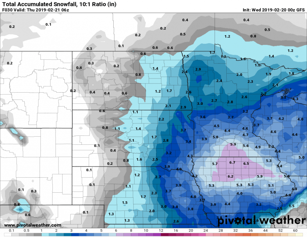
The GFS 10:1 ratio (1 inch of rain to 10 inches of snow) shows Mankato getting 6 inches.
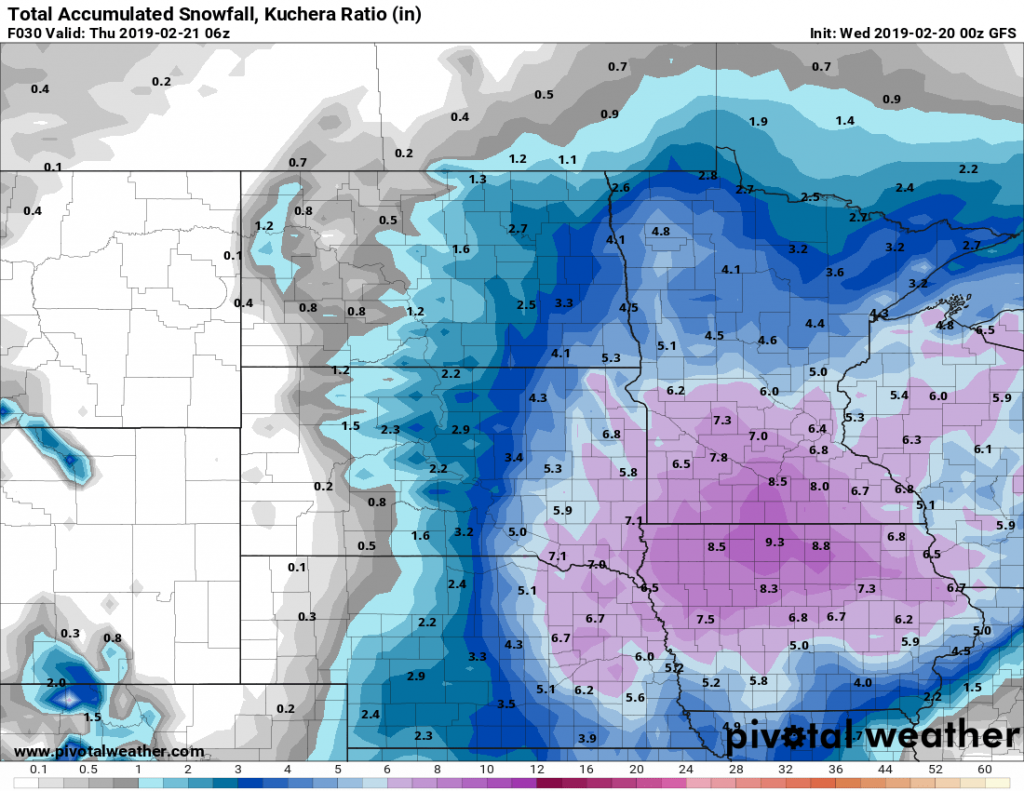
The GFS Kuchera Ratio (a more algorithmic calculation) is saying closer to 8.5.
GFS in some circles isn’t known to be the best. So lets look at the NAM which has a better rep.
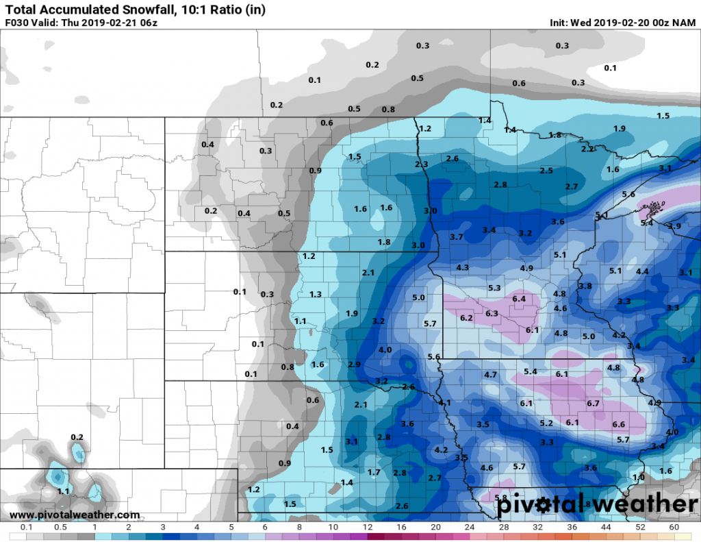
Again the 10:1 is saying 6 inches.
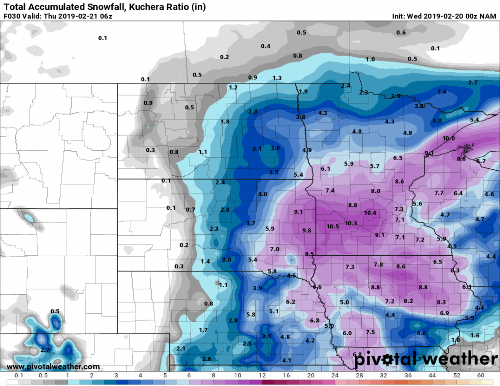
The Kuchera is saying 9.1 inches.
The other big model is the European model. Unfortunately, Pivotal Weather and Tropical Tidbits don’t have similar models for snow accumulation. So let’s look at Windy.
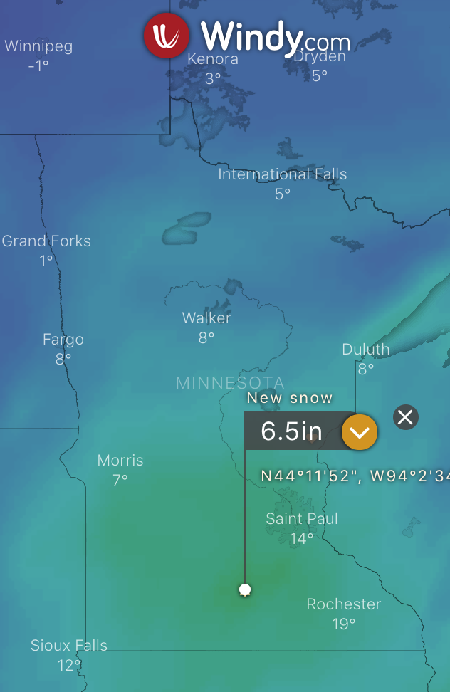
I believe this is the 10:1 model and it’s also saying 6.5 inches.
With that, I am going to match what most have been saying and keep the estimate at 6-9 inches of snow in the Mankato area.
Looking forward to the “big storm” it’s hard to tell as the models keep moving. What is known is that it is a bigger storm. How much depends on where it goes. At one point Windy had us pegged at about 18 inches of snow, that has gone down as the totals moved east. But it’s still several days away and the models will change quite a bit before then.
Until then, always keep updated and stay weather aware.
No responses yet